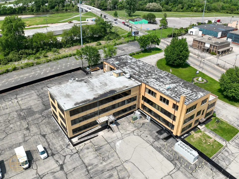
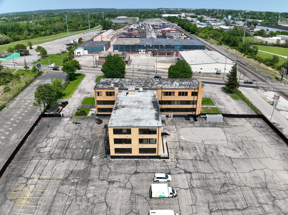
Drone-captured. Estimate-grade.
See the whole roof before you ever climb it
Drone-captured 3D models, orthos, and estimate-grade square footage. Your team flies — we handle the complexity.
Live 3D model
Explore a real roof — grab it and orbit
This is an actual GSI capture. Drag to spin, zoom, and inspect — the same model your estimators work from.
Where are you on the journey?
Scroll to climb. Each stage shows what it does for your Production and Service sides.
Getting started
Your crews are already on the roof. A drone just gives you the overhead proof you never had — the lowest-risk way to start.
Production
Are your warning lines always down? Overhead proof your crews set up right — no safety sermon.
- Dated overhead shot of warning lines and tie-offs, every job
- Catch staging and debris problems before they cost you
- A clean record for your safety file
Service
Turn "trust me, it needs work" into "look — here is your roof." The owner finally sees what you see.
- Owner-ready photos that justify the call
- Visual proof for insurance and warranty claims
- Before/after documentation on every visit
→ The lowest-risk way to put a drone to work tomorrow.
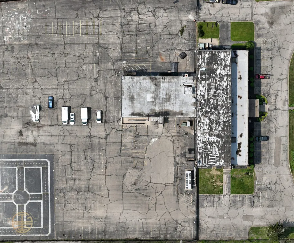
3D Models & Orthos
One flight becomes a measurable model — square footage you can bid from without running a tape across every parapet.
Production
Estimate-grade takeoffs that back up your walk and core cuts — tighter, faster bids.
- Measured area, slopes, and penetrations from the model
- Scaled orthophoto you can mark up and share
- Backs up your walk and core cuts — never replaces them
Service
Precise repair scoping and a measured baseline for every roof you manage.
- Pinpoint and quantify repair areas
- A measured baseline to track change over time
- Shareable maps for the building owner
→ Bid faster and defend every number you put on paper.
Full integration
Capture-to-estimate becomes a system — the same workflow on every roof, every crew, every time, with GSI as the processing backbone.
Production
One standardized capture-to-estimate workflow across every crew.
- A repeatable flight and processing standard
- Deliverables that drop straight into your estimating
- GSI carries the technical load so your team just gets a tool that works
Service
A living roof record per building — proactive maintenance you can actually sell.
- A dated history for every building you manage
- Turn reactive repairs into planned maintenance
- Portfolio-level visibility for owners
→ The drone stops being a gadget and becomes how you operate.
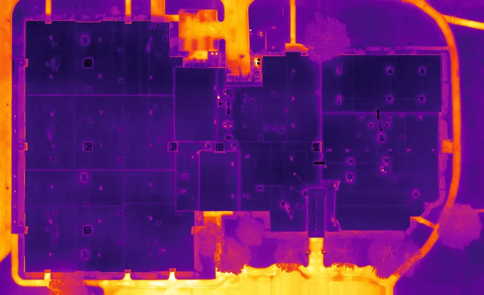
Thermal
The specialized side-path: see the moisture and heat loss your eyes — and the 3D model — can't.
Production
Prove the roof went on dry — thermal QA before you hand it over.
- Document a dry deck at close-out
- Catch trapped moisture before the warranty clock starts
- A defensible QA record for the owner
Service
Find the wet before you cut — thermal points you exactly where to core-cut.
- Target core cuts instead of guessing
- Map saturated insulation across the whole roof
- Scope tear-off vs. repair with evidence
→ Stop guessing where the water is.
The real difference is access to me
Drones and software are commodities — anyone can buy them. What you can't buy is the person who turns them into estimate-grade answers. You get me: years in commercial roofing, years in aviation, a commercially rated pilot — and someone who carries all the technical complexity so your team just gets a tool that works. And because I cap how many companies I take per market, when you're on my team, your competitor can't be.
Book a DemoWhat our clients say
[Client 1 — what GSI3D delivered for them, in their words]
[Optional: the measurable result]
[Client 2 — what GSI3D delivered for them, in their words]
[Optional: the measurable result]
Ready to bid faster — without climbing every roof?
Get inspection-ready roof maps and 3D models from a single drone flight.